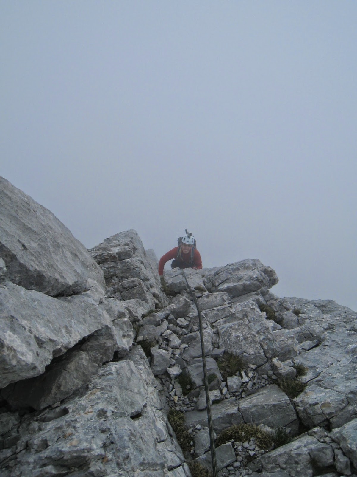
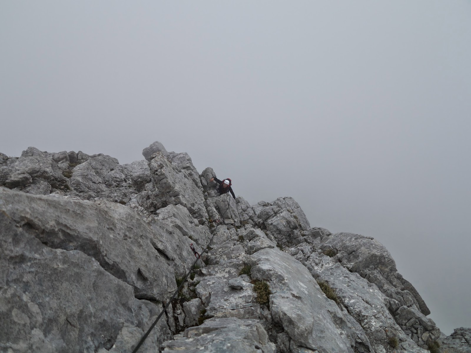
Partly due to the weather forecast, uncertain on the higher mountains, and also partly because I only had Sunday free...I decide to go once again to the Altmann, but this time via the East Ridge. Via Kletterportal I find someone that comes with me, which is good!
From the topo it looks quite easy, but we still decide to take with us several friends and nuts just to practice using them a little bit.
Approach walk is similar to the one I did one month ago, except that this time from the Zwillingpass we traverse a bit to the east to get directly at the bottom of the ridge. In all honesty, while getting there, the ridge looks actually quite steep...but this is only an "optical" effect which is quite normal. Mountains most of the times look steeper than they actually are from the distance...and when you get close they looks much less steep. Sometimes...they look even steeper when you get close to them...and then you might have a problem!!
View of the Churfirsten
There it is...for the moment not in the clouds
The beginning of the ridge...just before the clouds came...
A few minutes (OK...a bit longer than that) to prepare and then we start. In the meanwhile clouds are surrounding us...and they will never leave us until we get back down to the base of the mountain. I take the lead of the first pitch and it become immediately clear that the climbing is not difficult...but there are not that many bolts...even though it's quite easy to integrate with nuts, slings and eventually even friends. At the beginning route finding is not really an issue. Sometimes is a bit dubious but a careful look up high is enough to see where the next bolt is. The stands consist all of one single large ring. For sure that single ring would hold a very large weight...but nevertheless we try whenever possible to integrate a second piece of protection and then to link the two. Unfortunately my climbing partner drops one of his friends while doing this...maybe one of you will find it!
Me on the second pitch
On the 3rd pitch...I think!
The second pitch is the most difficult one and we both have the impression that the III+ grade reported on the topo is a little bit low. Surely the climb is always easy, but I'd say is closer to a IV in places...even though these differences are sometimes down to the personal judgement. I get a bit envious that my climbing partner gets to lead the second, hardest, pitch...but I get my "revenge" shortly afterwards. The beginning of the 5th pitch is, in fact, the nicest one. Up to the third bolt one has to climb on a rather narrow ridge with quite a drop on the left side. The feeling is really good! However, after the third bolt on this pitch the route goes to the right and it basically becomes a T5 path...After spending a very long time looking for the stand I just make one myself using two friends (always good to practice this kind of things).
Me on the 5th pitch
After this pitch we start walking together to try and see where the route continues. The terrain is really easy now and having fixed points in between is not really needed. Finally after a long search we spot a bolt and we know the route continues that way. This is actually the end of the 6th pitch. One more pitch to go and we finish the rock climbing part. Again there is no stand at the end of the 7th pitch but for a good reason. The pitch finishes on a terrace with a huge spike that can be easily used as an anchor point.
From now on is only walking straight up following the ridge over a series of large and comfortable steps (mainly covered in grass). This time there is no view from the summit because we it's all still covered in clouds. The time to eat something and we start descending following the normal route. Without snow and ice is a bit easier...but still not really a walk in the park. Taking care at where you put your feet is always good. Once the Altmannsattel is reached is just walking walking walking back to Wildhaus.
A really nice trip! Unfortunately not many pictures taken...but in the end it was all grey because of the clouds. It took a lot longer than expected to do the rock climbing part, but mainly because of route finding issues. Not difficult, but quite nice to get some training in being "exposed" and to train in using friends and nuts...and also slings. Now I've done this mountain twice in a month time...so I think I will take a break for a while :)...but I will come back for sure because there are several other nice routes especially on the south face.
One day looking at Hikr.org I come across a picture with a very interesting route drawn on it...and the interest rises immediately. That was the Eiger west face and the route was the winter-spring one, which is also used a ski touring route or as the descent route for those climbing the north face in winter and spring. The route is basically a very long snow and possibly ice ascent, with the steepest section at around 50°, graded as AD. It's the easiest route up this mountain. Nowhere close as famous as the North Face but that is still too difficult for my technical level...but one day I'm going to try that one also!
The plan is simple. Sleep at the train station Eiger Gletscher and start early in the morning for this long ascent (and descent). I was ready to go on my own but luckily I find someone else via Kletterportal.ch that wants to come with me. Since we are two, I also take a 30m rope and some basic gear in case of a tricky ice/rocky section. They will never be used...only dragged up and down. But I guess that can be considered as good training.
After an 80km bike ride on Saturday morning (always good to warm up before a long climb) get the train direction Kleine Scheidegg and walk up to the Eiger Gletscher train station, where I arrive around 19:00. Quick "dinner" and then in bed...before it was even dark.
A short breach in the clouds on the walk up to Eiger Gletscher
Another breach in the clouds
Wake up call is at 3:30 am, and at 4:15 we are outside making our way (hopefully) to the top. The trail starts just to the right of the railway tunnel that goes inside the Eiger. It follows the blue and white marks that lead to the Rotstock summit. In the dark and with the snow is difficult to see the signs and we only manage to see one of the many fixed ropes...so we end up making our own way up above all the ledges. The snow at this point is frozen on the surface but does not hold very well...let's hope it gets better later on. At around 2600m close to the notch of the West Ridge of the Eiger we see a tent of two swiss guys that camped here for the night...quite a nice spot actually. And we can also see them making their way up, no so far ahead. In a short distance from this point the large couloir under the huge serac starts. Until a certain point is possible to walk on the left hand side, having shelter under a rock face. At the end, one must get into the couloir, being completely exposed to the serac. Before doing this we take a short break because we know we cannot stop in the couloir for any reason whatsoever. Apparently there has been a recent serac fall and in fact avalanche traces are very visible all over the place. Therefore it should be "safe"...but you know...better safe than sorry. Getting inside the couloir and looking up at this large serac makes me feel strange. It's a bit like feeling at the mercy of chance...one can try to reduce the risk by being fast and crossing this before it gets hot during the day...but in the end a serac is always moving and it could fall at any time. I guess that's what mountaineering it's all about.
Look at that...
During the short break before entering the couloir there is the chance to admire the spectacle of the sun firing up the summits all around..."a million bright ambassadors of morning" (guess who's quote is this) which tinge of orange the summits covered in snow.
Luckily no issue in the couloir. The route goes up almost to the bottom of the rock wall underneath the serac, and then turns left. I guess the exact traversing point cannot be defined as it depends on conditions. In our case there was still plenty of snow and no ice, so it was rather comfortable. The serac can then be overcome on the left, on relatively gentle slope. Once above it, the temptation would be to aim straight for the ridge in front...but that is not a good idea. The route once again depends on the conditions, but this is what we did. We went up straight above the serac up to approximately 3500m and then started traversing to the left. The traverse is first at a constant height and then starts going up aiming directly for the summit ridge. At this point, finally, the second ice axe comes into the game. Not that it was really necessary...but I carried it all this way, and now the terrain starts to get steeper.
My climbing partner is following
The other rope party...roped up unlike us and making nice tracks :)
The snow is not as much as in one of description that I have read (http://www.chmoser.ch/trips/berichte/tourendetail.php?TourId=671) and we have to take a slightly different route, including a couple of short traverses on rubble barely covered in snow. Finally we reach the last slope where the conditions of the snow are absolutely perfect. It is evident that there is a new layer of snow (given the fact that it snowed one week before) on some older ice/really hard snow. With my two Petzl Quarks and crampons is a real pleasure to get up this 45°/50° snow slope...until the ridge is finally reached at around 3900m.
The very last few meters...the other two already on the summit
Looking back on the face, steep but not too much
Nice GoPro shot!
Sun glasses are finally worn because the sun has just risen beyond the summit and it starts shining on the west face. I can see the other rope party already on the summit, and I know it's not that far. On the ridge there is more fresh snow, and I try to stay away of the actual ridge as much as I can to try and avoid cornices. All the physical fatigue, thirst and so on just vanish all of a sudden once the summit is within reach...and within a few minutes I finally stand on the summit! Wow...what a view...how could you not be absolutely staggered by this? The wind is rather weak and the sun shines with very little clouds in the sky...and I could just take a deck chair and enjoy all this for hours.
What can I say...
Almost as soon as I get on the summit two alpinists are making their way on the summit ridge, coming from the North Face!! I look at them like if they were superheroes. The Eiger North Face is in my opinion THE North Face and being able to do it is a clear proof of really good mountaineering skills. One day, I promise...I will try it too.
These guys...
...just did the North Face
Grindelwald...only a FEW hundreds meters below...
Looking back on the West ridge from the summit...and people ski this stuff...
After having extensively enjoyed the view from the summit we start to go down...never forget that the summit is only half way! Several sections are "down climbed" meaning that we walk backwards. The two alpinists that did the North Face just walk down almost everything, except the really steepest bit...and they seem to be walking in the park. Clearly, a lot more experienced than me! However, even backward walking is quite fast because the snow is still in decent conditions. Only dangerous moment is when I'm once again under the serac. Now it almost midday and is very hot. I know there was a serac fall recently, but this does not make me feel any safer and I try to walk down the coluoir under the serac as fast as I possibly can. Once I'm out of the serac fall line I take a break rest...snow is getting quite soft and I sink more and more at every step. With the help of daylight is much easier to find all the fixed ropes and the way down on the last section proceeds really quickly until the train station of Eiger Gletscher is finally reached.
Again the steep section...this time going down
Still a long way...
What an experience. Technically not that difficult but considering that me and my climbing partner never roped up, and were also quite apart from each other almost all the time, it's like if I did the whole thing on my own. I never felt "scared" or exposed and finally I've properly baptised my two technical ice axes! Thanks to the good conditions there were no technical difficulties, but still it was physically quite tough since it involved almost 1700up and down in a single day, getting to 3970m. This time I took the easiest route up this mountain...but next time it will be the North Face...or at least the Mittellegi!
Alle volte non occorre andare nel cuore delle Alpi per gustarsi un bel giro alpinistico, soprattutto se non si è in compagnia e cose troppo impegnative sono anche sconsigliate...almeno per adesso. Ho letto diverse relazioni di gite piu' o meno alpinistiche nell'Alpstein nel canton Sankt Gallen, ma non mi ero mai interessato piu' di tanto. Vista la vicinanza di questa regione (anche se non è poi cosi' veloce da raggiungere) decido di comprare una delle guide del CAS per "capare" una bella gita, fattibile in solitaria. La scelta cade sull'Altmann, passando per il camino sulla parete sud. La via è data come PD, con arrampicata di II grado, in estate. Nelle condizioni in cui l'ho affrontato io era per metà in inverno, ovvero nei due canali, e per metà in estate, ovvero nel traverso tra i due canali. In ogni caso non credo sia piu' di un PD anche con queste condizioni.
La partenza è da Wildhaus alle 8:30. Certo non prestissimo, ma per partire prima dovrei dormire in zona...Si segue il sentiero per il Zwinglipass, che non presenta assolutamente nessuna difficoltà. La neve comincia appena sotto il passo, ma è comunque abbastanza poca per il momento. Una nota potrebbe essere che i segnali, che riportano 3h 30m fino al passo...sono secondo me un po' troppo conservativi (e non sono andato di corsa).
Eccolo li'...l'anziano...
Al cospetto della parete...praticamente sembra una mille foglie...
Arrivati al passo di norma si dovrebbe vedere un sentiero segnato bianco rosso, che punta alla Altamannsattel, passando alla sinistra (guardando la parete sud) della montagna stessa. Tuttavia la neve ora è abbondante e il sentiero non si vede...ma la cosa non rappresenta un problema e punto praticamente in linea retta verso l'attacco della via. Poco prima di arrivare all'attacco metto su caso (con GoPro) e ramponi. A giudicare da quanto molle è la neve fino ad adesso dubito che mi possano servire, ma visto che il canale è in ombra e visto anche che sarebbe molto scomodo metterli piu' tardi...preferisco metterli subito. Ed in effetti ho fatto bene. La neve all'interno del canale (per lo meno all'inizio) è abbastanza dura e procedere è un piacere. Anzi quasi rimpiango il fatto di aver portato solo una piccozza. Tuttavia le condizioni della neve sono molto variabili all'interno del canale. Essendo l'inizio di Maggio dopo un inverno alla fine dei conti non eccezionale, non ci si puo' aspettare poi molto dalla neve. Comunque per la maggior parte tiene bene anche se in un paio di punti ho "paura" di sprofondare in un bel buco :).
Sguardo indietro nel primo canale
Il primo canale è quasi del tutto coperto di neve. Ci sono solo un paio di piccoli salti che sono scoperti, ma che non creano grossi problemi. Bisogna solo fare un po' di attenzione al fatto che la roccia sembra essere abbastanza marcia. Il primo canale va seguito per circa due terzi della parete. All'inizio è abbastanza stretto e le pareti attorno sono quasi verticali. Poi comincia ad allargarsi fino a quando sulla sinistra non si vede una specie di fessura/diedro...ma non è ancora il momento di traversare sulla sinistra. Si continua fino a quando il canale non si allarga ancora di piu' e si nota che le rocce sulla sinistra diventano meno ripide. Guardando sulla sinistra si vede che, dopo un piccolo traverso che comincia su una piccola cengia, comincia un'altra piccola fessura. Questo è il momento di traversare sulla sinistra. Purtroppo non ho pensato di scattare un bel paio di fotografie per marcare bene la zona, ma per fortuna sono riuscito a prendere un paio di istantanee dalla GoPro, e ad ogni modo è abbastanza ovvio. Basta avere sempre in mente il fatto che prima o poi bisogna traversare sulla sinistra, e che il tutto è abbastanza semplice da essere classificato come un II grado. Immagino che d'estate ci siano anche delle frecce dipinte sulle rocce (all'inizio dell'ultimo canalone ne ho vista una che era scoperta dalla neve), ma forse nel mio caso erano coperte. Inoltre, sulle rocce all'inizio del traverso sono anche evidenti i segni dei ramponi.
Sguardo verso il basso poco dopo l'inizio del traverso
Il traverso, poco dopo l'inizio
Hmmm...meglio metterli bene quei piedi...
Sguardo indietro al traverso
La corta e ripida fessura alla fine del traverso
Il traverso non è difficile, ma in un paio di punti va ammesso che è abbastanza esposto...nulla che non si possa fare facendo un po' di attenzione. Poco dopo il traverso su raggiunge una corta e abbastanza ripida fessura che porta direttamente all'inizio del secondo canalone. Devo ammettere che fino all'ingresso del secondo canalone non era al 100% sicuro di essere sulla via giusta, anche se non vedevo alternative. Comunque, all'inizio del secondo canalone si vede una freccia rossa dipinta sulle rocce, e quindi sono ora sicuro di essere sulla strada giusta.
Sguardo indietro nel secondo canale
L'ultimo tratto della cresta
Il secondo canalone è molto piu' corto e anche meno ripido del primo. Verso la fine, guardando in alto a sinistra si nota la croce di vetta...segno inconfondibile che ormai "il meno è fatto"! In poco tempo si esce sulla cresta. Sulla sinistra, dopo qualche metro praticamente in orizzontale si raggiunge finalmente la croce di vetta. Una bella soddisfazione...molto bella. Non c'è nessuno sulla cima cosi' come non si vede nessuno su tutte le cime attorno. Tutto tace se non per il debole rumore del vento. Sedersi a contemplare il panorama mi regala, anche se per poco, un bellissimo senso di tranquillità e felicità.
Panorama dalla vetta 1
Panorama dalla vetta 2
Panorama dalla vetta 3
Ora pero' è anche arrivato il momento di scendere. Sono le 12:00 passate e le previsioni dicono che nel pomeriggio potrebbe iniziare a piovere. Quindi per lo meno vorrei tornare al facile sentiero...e da quel momento in poi pioggia, neve o anche grandine non sarebbero poi un problema grave. La discesa si fa seguendo la "via normale" che a tratti risulta essere piu' "difficile" della parete sud appena scalata. In realtà non è difficile, ma è solo che essendo coperta di neve di dubbia qualità (tiene e non tiene) non si sa mai se potersi fidare e quindi occorre procedere con cautela. Potrebbe anche essere che mentalmente, dopo aver scalato la parete sud, ho pensato di aver superato tutte le difficoltà essendo convinto di poter praticamente camminare fino a valle. Bisogna sempre ricordarsi che la cima è solo la metà della gita...e che nella maggior parte dei casi la metà piu' pericolosa deve ancora venire. Per sicurezza, e col senno di poi ho fatto bene, non tolgo i ramponi fino ad essere ritornato alla base della parete sud, dove si puo' osservare quasi tutto il primo canalone. In un paio d'ore, con un paio di fermate, ritorno a valle...estremamente soddisfatto di questa bellissima gita. Nulla di eccessivamente impegnativo, ma ormai sono quasi tornato agli standard di un tempo...forse.
La discesa...ripidina
Alla base della parete, si vede il primo canale
La via, in rosso i canaloni e in azzurro il traverso
Dopo oltre 6 mesi di infortunio...forse dovrei chiamarla proprio sfiga...cominciavo quasi a pensare che non sarei piu' andato in montagna. Poi come spesso accade in questi casi i miglioramenti arrivano tutto ad un tratto, dopo lunghi periodi in cui nulla sembra cambiare. Una volta appurato che nei movimenti di tutti i giorni i dolori sono spariti, decido di vedere che succede in montagna. Provo prima una piccola gita con racchette da neve e ramponi, ma la cosa implica delle eresie fenomenali...ovvero prendere ben tre funivie (OK due erano seggiovie) per arrivare al punto piu' alto di un resort sciistico e poi di li' partire. Ovviamente, visto che scendere rappresenta il problema piu' grosso per le ginocchia, prendo tutte e tre le funivie anche per scendere. Nonostante queste eresie, la giornata è stata molto bella e la sensazione di libertà che ho provato indescrivibile. Poi ho fatto una gita un po' piu' seria, questa volta tutto a piedi, salendo sull'Haggenspitz. Il sentiero era un T6 con passaggi di arrampicata di II, e un paio di esposti traversi su neve che ancora non si era sciolta. Oltre al fatto di aver quasi perso il cellulare, ed essendo da solo la cosa poteva rappresentare un problema, la gita è andata bene...considerando le ginocchia. Qualche fastidio ancora c'è, ma molto meglio di prima. Come di consuetudine, il Lunedi' di Pasquetta lo si passa in montagna, questa volta solo con mio fratello. Meta è ancora una volta il Pollino dove a quanto pare in inverno ci sono delle belle vie di misto, seppur corte. Solo che al Sud Italia il 21 di Aprile non è proprio inverno...guardando delle foto di gente che ci era stata qualche giorno prima, anche se le vie che volevamo fare non si vedevano proprio bene, decidiamo che le condizioni ci potrebbero essere. Si parte poco dopo il pranzo di Pasqua in modo da arrivare alla capanna di Colle Gaudolino prima che faccia buio e poter vedere la via. Le condizioni non sono delle migliori e sembra che un paio di passaggi siano belli scoperti di neve. Inoltre, dalle condizioni della neve trovate durante l'avvicinamento non credo ci si possa aspettare chissà che cosa.
Parete Ovest del Pollino. Appena alla sinistra del grande canalone centrale ci sarebbe la via che volevamo tentare
Comunque, decidiamo che una bella notte serena avrebbe forse fatto ghiacciare le neve a sufficienza da poter tentare la via. Purtroppo pero' di notte piove...quindi non solo il cielo non era sereno, ma le neve si è anche bagnata... Al risveglio allora (ore 4:30) decidiamo di aggirare la parete ovest per andare a tentare una via sulla parete nord, dove forse le condizioni della neve possono essere migliori.
Sul canalone al centro della foto si sviluppa la via, anche questa senza neve a partire da metà
Come si vede dalla foto anche questa via (canalone al centro, nome della via Psicologica) è scoperta nella metà superiore. Inoltre arrivare fin qui è stato molto piu' faticoso del previsto e sono già le 8:30. Per cui la neve non tiene un granchè...diciamo anche che non tiene per niente! Pero', alla sinistra di questo canalone si erge una cresta di roccia, quasi totalmente scoperta di neve. Visto che di equipaggiamento ne avevamo, decidiamo di tentare questa cresta. Non siamo a conoscenza di nessuno che l'abbia mai fatta, quindi non abbiamo idea di che cosa stiamo andando incontro. Metto su una sosta all'inizio della cresta e poi comincio a salire. Questa è stata anche una perfetta occasione per testare la mia nuova GoPro
La salita non è difficile ma la roccia è molto marcia e quindi si procede con molta attenzione. Su un piccolo spuntone lego una fettuccia come prima protezione e procedo in un diedro coperto di neve. Avendo ancora i ramponi la salita nel diedro non presenta grossi problemi. Alla fine del diedro grazie ad un secondo spuntone piazzo una seconda protezione e poi esco sulle placche. Fino a questo punto avro' usato una decina di metri di corda. Qui l'arrampicata comincia ad essere molto divertente. Usare solo le punte dei ramponi nelle piccole fessure è davvero esaltante. Tuttavia dopo pochi passi mi accorgo che la fessura nella quale speravo di mettere qualche protezione è coperta da un miscuglio altamente instabile di fango e sassi...non terrà mai il mio peso. Mi guardo attorno e non vedo molte possibilità per fare sicura. Inoltre guardando in alto la cresta sembra continuare a gradoni "al contrario". Non sembra difficile da salire ma a giudicare da quanto era marcia la roccia in basso non so se fidarmi di tutti quei gradoni. Inoltre non vorrei scaraventare macigni in testa a mio fratello, che si trova esattamente nella linea di tiro...per cui, decido di tornare indietro. Ormai data l'ora del giorno e le condizioni di tutte le altre vie si puo' solo tentare la via dei lupi, un facile canalone di pendenza massima 55°. Come direbbero i ticinesi, una fungiata!! Forse anche grazie alle condizioni della neve che permettevano di sprofondare a sufficienza la pendenza non ha creato nessun ostacolo tecnico...ma solo fisico visto che far traccia in questa neve non è roba da poco. E poi non c'è da dimenticare che negli ultimi sei mesi non ho fatto proprio un granchè di attività fisica di questo tipo...quindi non sono proprio al meglio della mia condizione.
La via dei lupi, al centro della foto...su quell'imbrago c'è fin troppa roba...ma le nostre intenzioni erano di fare vie un po' piu' tecniche di un semplice canalone.
In vetta
Panorama sui Piani di Pollino
Mio fratello conosce il Pollino come fosse casa sua e dopo l'uscita della via arriviamo subito in cima. Nonostante le temperature abbastanza alte (circa 5° in vetta) il vento è abbastanza forte e quindi fa abbastanza freddo...ma noi ci fermiamo solo per fare un paio di foto e per la solita stretta di mano. Decidiamo di ridiscendere con un ampio anello per andare a vedere il famoso Patriarca, ovvero il pino loricato piu' vecchio di tutto il parco del Pollino. Un albero veramente maestoso. Dopo 6 ore di sali scendi e piu' o meno celate gasteme nella neve bagnata, e di conseguenza con scarponi letteralmente fradici, torniamo alla capanna di Colle Gaudolino. Qui ci fermiamo per mangiare qualcosa e poi ripartire per tornare alla macchina. Il caldo ora comincia a farsi sentire. Peccato per le condizioni non ottimali, ma abbiamo scoperto una possibile nuova sfida sul Pollino. Secondo me quella cresta di roccia in estate si puo' fare...sempre ammesso che tutto il fango sia stato "pulito" una volta che tutta la neve si è sciolta. Altra nota dolente dell'uscita è stata il fatto di aver usato l'unica corda a nostra disposizione, ovvero una 70m di 11mm di diametro, assolutamente non impermeabile. Già a secco molto pesante...ma dopo ore in giro su neve bagnata è praticamente un macigno! Ad ogni modo, ormai posso dire quasi con certezza di essere guarito. Certo in alcuni momenti ho sentito dei fastidi al ginocchio, e quindi devo fare ancora molta attenzione e non fare troppo e troppo presto...ma visto che due mesi fa avevo dolore al solo pensiero di scendere una rampa di scale...direi che tutto questo è oro!!
Someone once said that life is made of a lot of small details. And that those details are important too. Well one of the details that makes me realize I'm going off to the hills is that my watch is not into watch mode anymore, but in altimeter mode. Since I've been back from Kyrgyzstan I've seen that altimeter mode only once...and not a single time for the last month. OK, except those moments when I just wanted to see how "high" I was. And that's because for the last month I've been "fighting" against an injury.
Injuries are a bad thing and I'm sure nobody enjoys them. This time the injury seems to the be IT band, and the so called "runner's knee". I said it seems because it's been a month doing therapy and stretching taking some pills and stuff but the damn thing is still there. It's not the first time I get these sort of injuries. Last year during the Jungfrau marathon I got in serious trouble with one of the tendons in the back of my knee. That time it was probably me being a bit stupid. I felt pain in the tendon 3 weeks before the race, but decided to go for it in any case. During the race the pains came back after a few kilometers. And then I kept going because they were bearable. After 21km an when it starts to go up the pain was close to be unbearable. At that time I asked myself: "do you want to stop now and maybe spend only a few weeks recovering, or do you want to push it to the end no matter what and then spend months recovering?". Guess what....it took me 6 hours to get to the end of the marathon. I was literally dragging my leg as I could not bend the knee anymore. And I was also stopping at all the first aid section to get some temporary relief. I was close to cry for the pain at some point and I had to stop several time just to get the pain away for a while. But I kept pushing and pushing until the end...I didn't care about my tendon and about anything else. I just wanted to get to the finish line. And so I did. Afterwards doctor, physiotherapy and stretching took me back to good shape.
The year before, again during the Jungfrau marathon I injured my Achilles tendon. This time it happened during the race but while I was running I did not feel anything and I actually enjoyed the full race. It took me 4h 42m to get to the end of the 42 km with almost 1900m of vertical ascent. Quite good considering that it was my very first marathon and my very first race over 10Km!! I felt some pain in my tendons at the end, but the day after I still wanted to go hiking for the whole day. You know, it's sunny outside, and staying at home looks like a crime against nature. Afterwards again physiotherapy, stretching, gels and creams...and I finally got better. The year before there was something else, but not during any race...and I can't remember anymore what it was.
What can I learn from all this? Respect your body! Your body knows what to do and signs of pain means something is not right. I thought I learned this after the first injury, but reading back my history I probably did not. And after this last injury I have my "new year's resolution" saying that I will do stretching every day and I will do exercises to make sure all the muscles that are important for running are always in good shape. I bloody well will do! I'm pissed off of spending two months or more each year recovering from injuries. If they came from something else like an accident it would be different. All of my injuries always came from me overdoing stuff, believing I was some sort of "invincible runner" and not caring much about the small signs my body was sending me. But this is over............................last famous words :) ?
Let's be fair, one month "off work" is not such a bad thing. But I love my knees as if they were my own kids and seeing one of them struggling to heal is not the best. But hey, only death has no remedy (not yet) so it will get better!
This post is not matching with the title of my blog, this is no adventure. But I was missing a bit writing in here. However, for you reader that kept reading until the end, this is what keeps me going during my morning routine of stretching. In my opinion, the best piece of music ever recorded.
Leaving the advanced base camp gave a sort of sad feeling. We spent 5 nights up there and it started to feel like home in a way. Even the routine starts to kick in. But the idea of leaving for a warmer place and especially for the possibility of getting washed was "irresistible" :). Unfortunately on our last day at ABC we did not climb anything because the weather was rather bad in the morning. So we just waited for the snow to stop, packed the tents and rucksacks and hiked back down to base camp.
Bad weather was firmly convinced not to leave us so we had to wait for very short windows of decent weather to get a wash in the river. Having no sun and cold winds made the washing an extremely refreshing experience. The evening goes on with everyone sitting in the common tent, chatting, drinking and eating. It's nice to be all together again in the same tent. And it's also very nice to see the truck that fell off the bridge standing again on its six wheels. It looks quite badly bashed, that is true, but these vehicles seem to be really resilient.
Dismantling base camp
Trying to save the truck underwater...not quite there yet
intermediate camp before Son Kul
In the morning we start driving towards the Son Kul canyon, but we already know that we are not going to make it there in a day and we'll have to camp somewhere on the way. We cross again that river where the other truck was stuck half underwater and again the same bloody bridge. Once again our driver decides to cross the river in the water rather than risking the dodgy bridge. After several hours on the go and lots of bumps and holes in the road we reach our camp site for that evening. An idyllic spot, kissed by the warm sunset sun and at the same time gently refreshed by winds. It's strange to feel somehow warm after 7 rather cold nights, two at base camp and 5 at ABC.
Finally the day after we reach the Son Kul canyon shortly after 2pm. Just the time for a quick lunch and off we go to have a look at the canyon and to decide which routes we are going to attempt on the following two days. Some people of the group (naturally including the guides) have already climbed here before and some routes have already been opened. If such a place was in Europe it would probably have several dozens of routes. So it's easy to imagine the excitement of being there and knowing that basically most of these awesome rocks had never been touched by a human hand.
Me and my rope partner pick up a line that looks doable, rather close to the line that one of the guides has chosen. This way, even if we climb on our own the guide will still be able to hear us and, hopefully, give us some help if needed. However today is too late to start climbing so we go back to the camp and enjoy a sunny afternoon.
Camp at Son Kul
Typical landscape of the canyon
Early start is not a must anymore...rather the contrary. We are not going to leave the camp before the sun hits it, which is happening around 7:00 am. Backpacks are this time much lighter than they used to be in the high mountains and also clothing is much more basic. I'm even taking a fleece with me, but that won't be needed. To get to the climbing spot we need to cross a river and since this is rather deep we end up taking off shoes, socks and even trousers. Cold water on the feet in the morning is a good way to wake up. More walking and scrambling through bushes and stuff and finally we get to the beginning of the route. Starting an unclimbed route is an unusual experience, at least for me. We have no idea if it will be possible to get to the top or if we will have to abseil off at some point. Naturally the route is all done on trad gear and, very interestingly, it will be the first time I'm going to lead a route on trad. I've used trad gear before on mountaineering routes, but on grades not tougher than AD+. This route does not look that difficult from the bottom but having the first lead on trad on an unclimbed route is something really exciting. The first pitch goes on without problems, but very slowly. Climbing unclimbed rocks one must always be careful not to knock anything off...and especially not on the belayer, you know...On the second pitch is my time to lead. It starts with a long traverse with lots of nice horizontal cracks where the cams are getting in nicely. Unfortunately straight after the traverse the route gets steeper and then the rope drag is too much to continue. So I'm forced to set up and anchor and stop here. The beginning of the third pitch is probably the most difficult part of the climb, even though the route cannot be called difficult. Me and my friend reckon that this must be a 4a/4b...what the swiss would call plaisir! I make a little mistake in setting up the anchor and the end of fourth pitch and pulling up the two ropes is much more tiring than the whole climb. And to make things worse, when I start belaying the leader on the fifth pitch we manage to tangle the rope in a way that the two are tied into an overhand knot. How the hell did that happen??? No worries, just remember the 3 golden rules of mountaineering:
Look cool
Shit happens
If shit happens...look cool anyway!
and so I do...keeping my cool look on my face I untangle the rope and follow the leader. We take a short break to drink something because it was getting too hot and then I start what is going to be the very last pitch. The feeling of getting to the top of an unclimbed route is really....really...I don't know, can't find the right word for it. It's just a weird feeling, a mixture of happiness and somehow sadness at the same time. Happiness because we made it and sadness because it's already over and because in the end we did not have to push too hard for it. Since the route looked more difficult from the distance but it was actually rather easy we are going to call it "Scotta". This is an italian word that means the opposite of "al dente", and which sounds very similar to Scottish. The route would have been "al dente" if it had been tricky and tough, but since it was not it was "scotta". And my climbing partner was scottish, so that is a very good name for it. My first route leading on trad is also a new route...I don't know how many people are lucky enough to get that.
Overview of the route Scotta
Beginning of the first pitch
On the very last pitch!
Back at camp...relaxing
There is not much to say about the second day unfortunately. We were planning to attempt another new route but getting to the bottom of it involves a massive walk and we realize this only once we try to get there. So we end up repeating one route that has already been done during last year's expedition. This route is on a ridge and is called the swiss ridge because it really looks like an alpine ridge in the swiss alps. Morning of the following day we pack our stuff and the tents for the last time and off we go...back to civilization! Once back in the hotel is not possible to feel to edge of heaven by looking at the shower and the toilet...how cool is that! After two weeks of rivers and squatting (you know what I mean) this is one of the best thing I could think of. This has been probably the best trip I have done so far. Lots of new experiences and lots of excitement. And this kind of experience is difficult to get somewhere else. For sure I could have joined some trips where higher and more difficult mountain had to be climbed...but nowhere else I could have get to try the experience of getting into the unknown, the real feeling of exploring. Definitely worth trying. And actually...I'm seriously considering joining this trip also next year!
Back in Bishkek we keep the adrenaline high with some flight
Bazar in Bishkek, 1
Bazar in Bishkek, 2
Bazar in Bishkek, 3
Bazar in Bishkek, 4
Bazar in Bishkek, 5
Braciole on the menu...being from Bari in the south of Italy I must be proud of it!